

E-5’s 9.43-km swim across Bansagar raises new questions about elephant movement and wildlife corridors in Central India
By Lalit Shastri
Bhopal: When forest officials began tracking the movements of radio-collared elephant E-5, they were watching an animal whose movements had already proved unusual. What they witnessed next may have implications far beyond the story of an elephant capable of swimming nearly 10 km.
E-5 has crossed the Bansagar reservoir twice – and, on its return journey, swam 9.43 km through the deep, still waters of the reservoir before reaching Jamni village in Beohari, Shahdol. The feat was first observed and tracked by forest officials monitoring the animal.
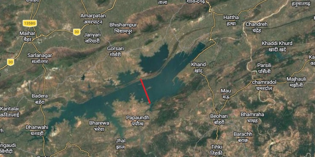
After spending 22 days in Maihar, E-5 crossed the Bansagar dam’s backwaters near Pumaria and reached north Shahdol through the Bandhavgarh forest landscape. The elephant had earlier entered Ramnagar on September 27 before turning towards the reservoir. Forest officials said the animal was subsequently heading towards Bandhavgarh after crossing the reservoir for the second time.
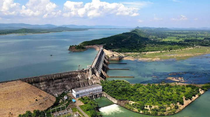
The episode is remarkable not simply because of the distance covered in water. Bansagar is not a flowing river. The reservoir is 30 to 35 metres deep at places and has no current that could carry an animal along. E-5 appears to have made the crossing under its own power, entering the water from Singhpur Barondha in Maihar, swimming towards an island, spending some time there and then continuing its journey.
The elephant’s movements have to be seen in the context of a much larger journey through a landscape shared by forests, villages, agricultural land and human settlements. E-5 had earlier been involved in a rescue operation after killing a 60-year-old farmer and damaging houses. Six elephants from Bandhavgarh were involved in efforts to manage the animal. It was subsequently radio-collared, allowing forest officials to follow its movements across the landscape.
What makes the Bansagar crossing particularly significant is that E-5 did not merely enter the reservoir once. After spending weeks on the Maihar side, it crossed back towards Shahdol.
That raises a larger question for wildlife scientists and conservation planners: can a reservoir that appears on a map as a barrier actually remain part of an elephant’s movement landscape?
The question assumes importance in a region where the creation and raising of the Bansagar reservoir have altered routes historically used by wildlife.
A performance audit by the Comptroller and Auditor General had earlier recorded that a wildlife corridor in North Shahdol, connecting the Panpatha Wildlife Sanctuary landscape of Bandhavgarh with the Sanjay-Dubri landscape, had been frequently used by tigers and other wild animals. The audit noted that the rise in Bansagar’s water level following the raising of the dam made movement across the area difficult and effectively closed that channel for terrestrial wildlife.
The CAG observation concerned terrestrial wildlife and did not establish elephant use of the route. But E-5’s movements introduce another dimension to the question of connectivity. A landscape that may be difficult or impossible for an animal moving on land to cross may not necessarily be impassable to an elephant capable of sustained swimming.
This is particularly relevant as Madhya Pradesh is undertaking scientific work with the Wildlife Institute of India to map elephant corridors, habitat use and human-elephant conflict hotspots across the Bandhavgarh-Sanjay landscape.
E-5’s journey provides an unusual field observation at precisely the time when scientists and forest managers are trying to understand how elephants are using this changing landscape.
The question is no longer simply where elephants walk. It is where elephants choose to move when confronted by roads, settlements, agricultural fields, rivers and reservoirs.
This distinction matters in Central India, where the landscape available to wildlife has been progressively divided by infrastructure and water projects. Conventional corridor maps generally emphasise stretches of forest and land through which animals move. E-5’s journey suggests that the ecological map may sometimes be more complicated.
A reservoir may be a barrier for one species and a passage for another. For elephants, water itself may therefore have to be considered as part of the movement landscape.
There is another intriguing aspect of E-5’s journey. The elephant crossed the reservoir, spent considerable time on the other side and then returned through the water. The available information does not yet establish whether the animal deliberately retraced precisely the same route or whether the two crossings merely converged on similar points of entry and exit.
That is a question that the detailed GPS data from E-5’s radio collar may eventually answer. The collar data could reveal the exact entry and exit points, the duration and speed of the swimming sections, the time spent on the island and the degree to which the return journey corresponded with the earlier crossing.
Such information could help determine whether E-5’s crossing was an extraordinary one-off event or evidence of a movement capability that deserves consideration in future elephant corridor planning. The immediate lesson, however, is already clear. A corridor is ultimately not merely a line drawn on a map. It is a route used by an animal.
If E-5’s movements are examined alongside the detailed collar data and other elephant movements in the region, they could provide a fresh perspective on how Central India’s elephant landscapes should be understood. The map may show Bansagar as a barrier. E-5’s movements suggest that, for an elephant traversing its landscape, the reservoir may be a barrier only on paper.
