Tapan Misra
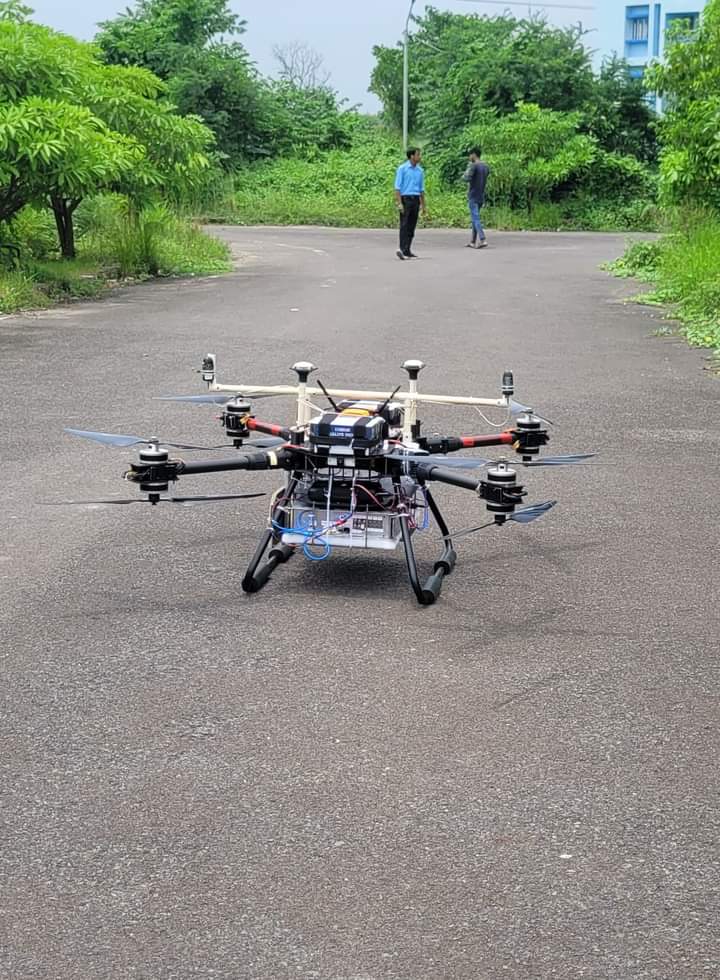
Kolkata: SISIR RADAR has demonstrated game changing imaging technology with indigenous development of ultra high resolution, L-band Synthetic Aperture Radar on low altitude drone platform.
We are proud for our path breaking achievements namely:
- Made in India and Made for India SAR, developed and demonstrated for the first time by a private company in India. Till now only ISRO possessed this technology
- First SAR on low altitude drone, completely made in India. Globally we may be the latest entry among a few who can be counted in fingers.
-First SAR in India built with software defined radar architecture. - Our SAR has resolution of 0.75 m in along flight ( Radar people call it Azimuth) and 1 m along across flight ( so called Range direction). Let me put the record straight. Usually the best possible resolution in SAR is around 10 times the wave length. So an X band SAR can give best resolution around 30 cm for an wavelength of 3 cm. For an L band SAR, the industry standard is around 250 cm or 2.5 m for wavelength of 25 cm. What we achieved is an unthinkable resolution of 75 cm or 3 times the wave length.
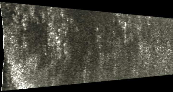
We present our first image over a forested area of 250m x 500 m in Haringhata in West Bengal. Keep watching us as we will bring out newer and newer features like polarimetry and interferometry. We had to invent a completely new algorithm for motion compensation and processing of SAR, flying like a toy in monsoon winds ove Bengal landscape.
With this image, we offer a SAR, available at very very competitive price at any standard, to bring SAR imaging at affordable price for numerous application in India and globally.
SISIR RADAR was christened after Prof. Sisir K Mitra, doyen of atmospheric physics research. It is a sheer lucky coincidence that that we are testing our L band drone-SAR in Haringhata, where Prof. Mitra established ionospheric research station in late 1940s.
From my long experience I can vouch: each SAR system, specially the ones with brand new innovations, has a personality which needs to be understood to bring out its best performances. Needless to mention, no personality can be understood without its surrounding environment. Similarly the drone SAR complexity is multiplied many times by dynamics of drone platform, flying like a floating toy in the monson wind.

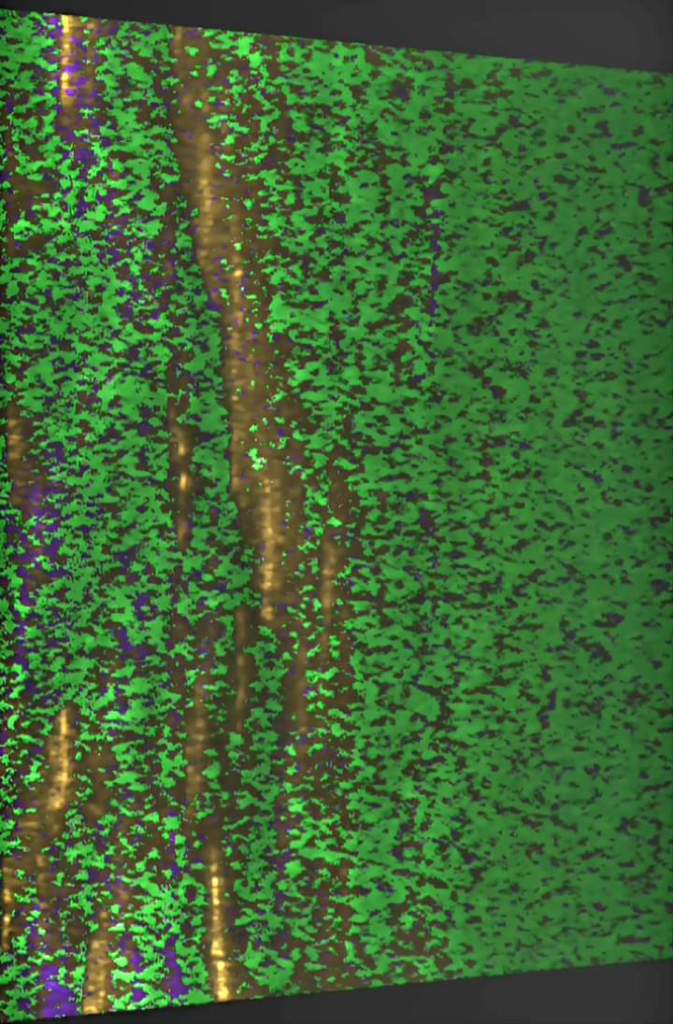
We are proceeding with well designed tests, one after another, to bring out the best from our SAR and it’s signal processor. Presently we tested polarimetric performance at high incidence angles of 82+ degrees from an altitude of 50 metres. Initial level of performance is very satisfying. For uninitiated, the vertical structures like tree stumps, vertical walls are identified in orange colour; flat surfaces like rooftops, sloping roofs, plain grounds with indigo colour; and vagetations, tree canopies, monsoon growth of wilderness as green colour. Image size is approximately 200 m along flight and 500 m across flight direction.

We are learning many many new nuances of ultra high resolution L band SAR as nobody ever was exposed to such data. We are collectively being reminded that SAR is coquettish enough to throw up unexpected surprises at the drop of a hat, challenging our understanding of SAR technology, on daily basis. Learning is a never ending exercise, if your passion is to solve the riddles of SAR system and it’s signal processing.
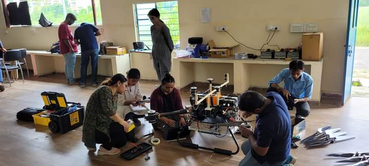
I take this opportunity to congratulate our young Team SISIR led by Urmi Bhambhani and Soumya Misra for developing the SAR within just one year of recruiting our first team member. I am personally grateful to my school classmates Dr Pinak Pani Bhattacharya, Partha Bhowmik, Cabinet Minister in Govt of West Bengal and Dr Nabarun Bhattacharya for encouraging us to take the first plunge. We are thankful to MAKAUT ( M A K Azad University of Technology) management, teachers and students for actively supporting and facilitating the test flights within their campus in Haringhata.
Postscript: We are discovering new learning on the nuances of SAR processing, GPS aiding of INS data and motion compensation while trying to bring out the best out of our ambitious ultra high resolution L band drone SAR. The small SAR on drone platform came at a heavy cost of algorithm innovation and massive parallel computation. You can count each tree and bush in this 500 m x 500 m polarimetric image from our drone SAR. Processing this image called for more than 16 hrs of computation time on an 88 core machine! Daily we are getting humbled with the realisation of hidden beauties of SAR technology behind the veneer of daunting mathematics.

Tapan Misra, is founder of SISIR Radar. He is a distinguished scientist. He was Director Space Applications Centre and is recognised globally as father of Indian SAR (Synthetic Aperture Radars)
